- Bike: mtb
- Difficulty: ****
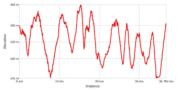
- Distance: 29 km
- Altitude difference: 289 m
- Total ascent: 1072 m
- Total descent: 1073 m

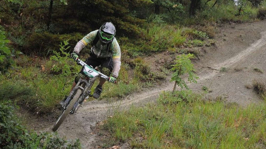
One of the five most beautiful enduro trails in the Piedmont region, according to writers at Red Bull, the “3 Fiumi enduro trail” is for mountain bike riders who have very good bike control and high expertise of technical trails. This route is a slight adaptation of the original race course; it includes four hills to climb and therefore four technical descents. Racers used to be timed in stages.
The route was designed by a group of friends who later founded the ASD Enduro dei Tre Fiumi amateur association in Cartosio. It is mainly designed to be fun, with some technical and physical challenges added in, but without impassable stone quarries or two-metre drops. Indeed, this mountain bike enduro trail could also be tackled with a cross country bike, albeit not too quickly and with caution. Obviously, to really go fast or to set a time, a bike with a bit more suspension travel, as well as considerable technique and training, are advised.
The special stages were mostly held on specifically designed singletracks, including many gradient changes, bends and humps, which remain for those who wish to challenge themselves today. As is customary, the most technical stretches are christened by their creators with the most bizarre and original names. The four stretches that truly enthused enduro racers are: Gli Arbi (The Trees), Il Cane Morto (Dead Dog), La Panoramica (The Scenic) and La Speciale (The Special).
The race track was developed to include some short stretches that were part of the legendary 120 km overall distance traversed by the three rivers of this area. Thrilling new trails were added, and the entire circuit was shortened to the classic race distance of about 30 km.
As with any off-road track, it's difficult to provide a comprehensive description, so please use the GPX. However, some of the stretches are marked by local bikers and follow the CAI (Club Alpino Italiano) path no. 573. Start in Cartosio, from Piazza Umberto Terracini, where there is a car park and you can fill up your water bottle, then head towards Acqui Terme. After 300 m, keep right towards the hamlet of Dianiglia and just before a bend turn left onto a track that takes you on the Sassello SP 334. Once on tarmac, turn left and after 100 m left again, towards the hamlet of Bernardi, where at the end of the tarmac you go up a track. There aren't many useful landmarks here to describe the route, but after 4.5 km the climb ends and after a descent of about 1 km and a brief incline, the trail goes steeply downhill for another kilometre. From here, the second stretch rises for about 3.5 km. The technical descent is about 2 km long, after which you start climbing the longest uphill stretch to the route's highest point (480 m) for the first time.
Go downhill and after about 700 m turn right onto another very technical descent, until you reach 300 m altitude. Then climb up to the highest point once more; go back down but this time don't turn right. After 2 km of steep descent you're over the hardest part and after some ups and downs you reach the bottom of the valley and cross once more the Erro stream. Climb towards the shrine of Pallareto for a last, brief uphill stretch, first on the SP 212 and then, turning left on a track, along fields and woods: a scenic tarmac stretch that takes you back to Cartosio.
