- Bike: mtb
- Difficulty: ***
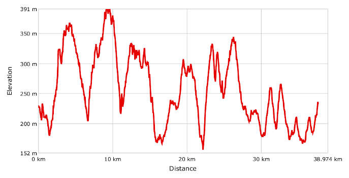
- Distance: 39 km
- Altitude difference: 239 m
- Total ascent: 1323 m
- Total descent: 1325 m
The vast Cerrina valley lies in the hills of Monferrato Casalese, bordering the Po plain to the north and the hills of Turin to the west. The various initiatives to promote the area include the classic San Martino eco-marathon, a race run over two beautiful days in autumn. The woods and vines are cloaked in beautiful shades and the must of new wines, 'foaming in their vats', fills the air, intoxicating the revellers at the 'spring of San Martino' , a feast celebrated on 11 November.
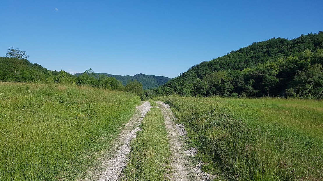
It's a classic race but also something of a nature walk, down paths and through meadows and woods.
It's a chance to get to know, share, promote and build a culture of well-being and sport. Five municipalities are involved: Cerrina Monferrato, Mombello Monferrato, Gabiano, Villamiroglio and Odalengo Grande. They have come together to promote an important sporting and natural event.
The route described here is for cyclists and is therefore longer, with a few small changes, for practical reasons, to the one used for the race. The marathon is 42 km long, with variants of 21 km and 10 km. For runners, it's a pretty demanding distance, but for cyclists it makes for an easy, pleasant trip, albeit one with a fair overall climb.
Start in Piazza Martiri Internati in Cerrina, the main village in the municipality. Here in the square you'll find the council building and the parish church. Go down onto the track by the little church of San Sebastiano, down then up to Case Bolli. Cross the tarmac on Via Indipendenza and go on to the second kilometre. Turn left here up the roads to Varengo. Keep going uphill on the track Via Rairolo, then down to Perosio. Pass the farms here and get onto the dirt road to Montalero, arriving in the village on Via al Castello, which turns from a small tarmac road into a woodland track over the highest point on the route, Monte Favato at 445 m. Once you've passed the farms in the hamlets of Incasale, Incasalone and Bussi, near Odalengo Grande, you go on to the village of Villamiroglio, which you must cross to get to the hamlet of Casa dei Rei. From here, follow the GPX track to the village of Sessana and then Gabiano, the main village in the municipality of the same name, up to Piazza Europa, where you'll find the local council building and a splendid view. Carry on to Cantavenna and, after about 1 km, take the path on your left to the bottom of the valley, towards the river Po and back up to Cantavenna.
The route carries on here along a series of paths that you'll only work out with the aid of your GPX track. Go around the village, through woods with beautiful views. Head back from Cantavenna, uphill through vineyards and little paths to the bottom of the valley.
After a few ups and downs, the seemingly endless paths will bring you to Pozzengo. After about 1 km, the path will bring you to Mombello Monferrato. Go down to the SP 9 and turn onto Via Roma, which soon becomes a track. Go further down to meet the SP 9 again. Cross it onto another track, which brings you to the SP 1. Take the track you see before you and you'll be back in Cerrina Monferrato after a short uphill push.