- Bike: strada/trekking
- Difficulty: ***
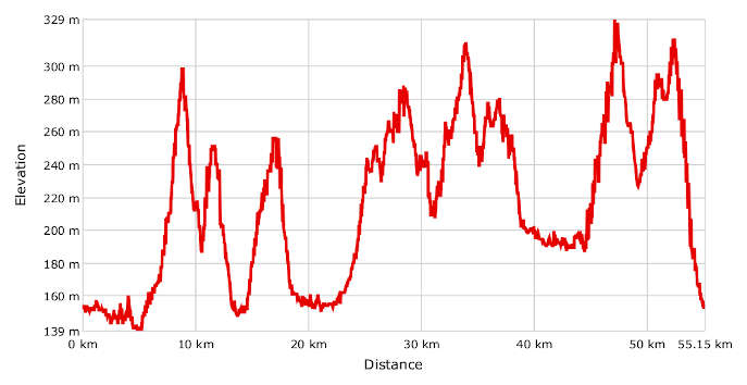
- Distance: 55 km
- Altitude difference: 190 m
- Total ascent: 826 m
- Total descent: 826 m
Leave Canelli along the river Belbo in the direction of Nizza. After 5 km, turn left for San Marzano at the church of San Giovanni delle Conche. Go slowly uphill through rows of hazel. Over the last 1 km, the slope reaches 8–9%.
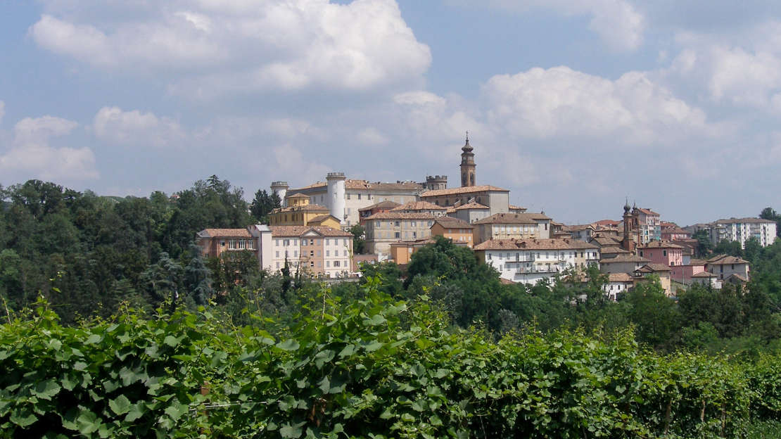
Once you arrive in San Marzano (9 km of total route), with its beautiful medieval castle, go downhill and after about 1 km turn right to head onto Regione Chierina. After 800 m you'll come to a crossroads. Turn left onto the road leading up to Moasca (11.5 km), where you can visit the recently restored medieval fortress. Leave the village here, heading down to the junction with the SP 6 by the church of the Annunziata. Turn right for 1 km along a road with a fair bit of traffic, until you get to the junction. Turn left here for Agliano Terme (13.5 km). Follow the directions gently downhill to the village. On your left, go downhill to the flat area around the spa, camp site and swimming pool. Carry on until you join the former state road to Asti, in front of the town of Montegrosso. Turn left on it until you reach the roundabout that links it with the SP 39 to Costigliole. Go through Vallumida and up to Santo Stefano (25.1 km). Carry on to the 18th-century shrine to the Madonnina. Go on to Costigliole d’Asti (30 km), then on to the church of the Annunziata, then downhill to Castagnole delle Lanze. Head down towards the station and onto the busy provincial road, which follows the railway until Boglietto (43.3 km). Turn right along the road through the valley, and leave it after 1 km to go uphill towards Calosso. After 3 km of vineyards, you'll arrive at a junction. Turn right for Calosso, then go down on your left towards Canelli. A few more kilometres uphill will bring you to the village of S.Antonio (52 km). The last stretch of the route begins here, over 2 km leading sharply downhill to Canelli. 55 km in total.