- Bike: trekking
- Difficulty: **
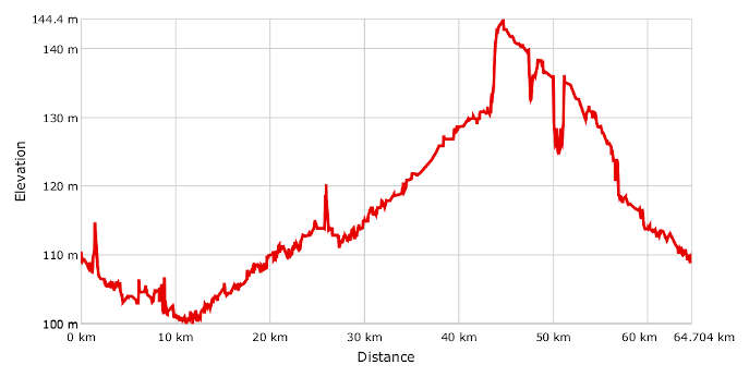
- Distance: 65 km
- Altitude difference: 45 m
- Total ascent: 220 m
- Total descent: 221m
Villanova, which added 'Monferrato' to its name in 1878, lies in the flat country north of the river Po.
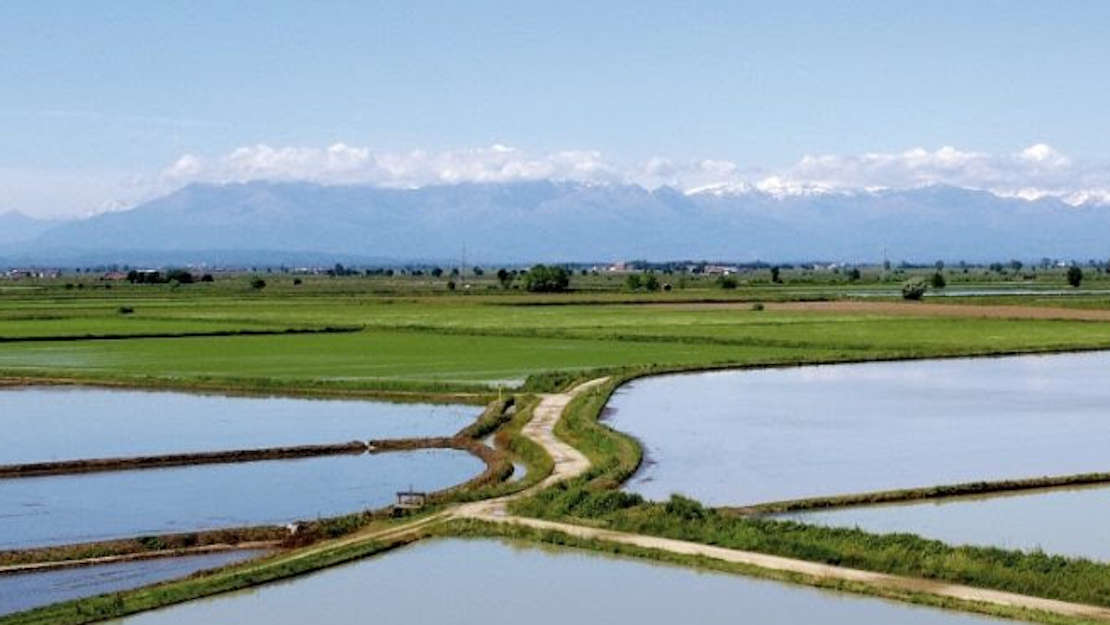
This route is easygoing and runs over flat roads through the rice fields of Monferrato. It's a charming trip round the edges of the Po natural park, on the borders of the provinces of Vercelli, Alessandria and Pavia, between the Po and the Sesia, where the Marcova and Roggia Stura empty into the second of those great rivers. The route is mostly on gravel tracks used for threshing rice and once cycled down by the hundreds of rice growers going to work in the fields.
Your starting point is Villanova Monferrato, opposite the town hall in Piazza Finazzi. Head off in the direction of Motta de' Conti, the municipality linking three provinces and two regions. The village of Mantie, home to about forty, is on the other side of the Sesia, a slice of Piedmont jutting out into Lombardy.
Carry on from the sleepy village along the banks of the Sesia. Go along the river Marcova almost until it meets the Po. Follow the route on your GPX track until you find the Po, and go along its banks to Casale Monferrato, passing near the village of Terranova on your way. From Casale the route continues to the nearby village of Popolo, then over rice farmers' tracks to Balzola. From this village, take a series of tracks to Trino. Once you've got through the town, head down some more country roads to the village of Robella. Take some quiet tarmac roads to Torrione, where it's worth taking a quick detour to Due Sture, then head on to Rive, a village with a castle that was once an important military defence. Carrying on along tracks through rice fields, you'll cross Canale Magrelli and reach the provincial road between Morano and Due Sture, which will bring you to the end of the route in Villanova Monferrato.